

#R1
1883
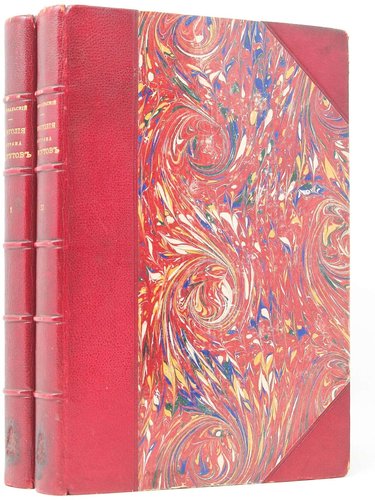
First edition. Quarto. [6], iv, ii, 473, [1 - errata] pp. With 108 lithographed and woodcut plates (three folding), two large folding chromolithographed maps at rear and ten woodcuts in text. Handsome period dark green quarter morocco with cloth boards; spine with raised bands and gilt-lettered title and owner’s initials “N.L.” Both boards with blind-stamped decorative borders; marbled endpapers; all edges coloured. The folding maps with several minor tears, but overall a very good copy.
Official account of Przhevalsky’s third travel in Central Asia in March 1879 – October 1880, during which the expedition explored northern Tibet and the upper reaches of the Huang He River, discovered two mountain ranges in the Nanshan (Qinling) Mountains east of the Altyn-Tagh (named by Przhevalsky after Humboldt and Ritter) and managed to get to the closest distance to Lhasa, which was the dream of Przhevalsky’s life. The expedition was stopped by the Tibetan ambassadors near the town of Nagqu, just ten versts (about 10,7 km) from the private domain of Dalai Lama and 250 versts (about 267 km) from Lhasa. The book includes the Russian translation of the Tibetan official paper forbidding Przhevalsky to penetrate Tibet any further (pp. 276-277). It also describes Tibet’s geography, administrative divisions, roads and settlements, local people (Mongols, Tibetans, Chinese, Tanguts, Dungans, etc.) and Buddhism, Lhasa and Dalai Lama (based on conversations with Chinese merchants and soldiers). The illustrations executed after the original drawings of the expedition artist Vsevolod Roborovsky (1856-1910) include portraits of the expedition members, native people, Tibetan ambassadors, views of Hami (Kumul, eastern Xinjiang, China), Humboldt Range, Qaidam Basin, mountain passes in Tibet, Lake Kokonor (Qinghai), Huang He River etc. There are also plates showing Przewalski’s horse and a Tibetan blue bear, discovered by the expedition. The two large folding maps at rear have the identical titles “A map of the exploratory route surveys during the second (1876, 1877) and third (1879, 1880) travels of N.M. Przhevalsky in Central Asia.” The first one roughly covers the territory of modern-day Xinjiang Uygur Autonomous Region of China, from Lake Zaysan in the north to Altyn Tagh range in the south and from Ghulia in the west to Hami/Kumul in the east. The second one shows southeastern Xinjiang Uygur Autonomous Region and Qinghai Province, with parts of Tibet and Gansu, from the Tarim River and Lake Lop Nur in the north to Nagqu in the south and from Cherchen (Qiemo) in the west to Lanzhou in the east. The area southeast of Cherchen (Qiemo), corresponding to the territory of modern-day northern Tibet, is marked as “the entirely unexplored land.”
“In 1879 Przhevalskii launched his third and most successful attempt to reach Lhasa, starting again from the Altay region but this time passing to the east of the Dzungaria Basin to arrive on the Silk Route at Hami. From here he and his thirteen armed men proceeded in a south-southeasterly direction, crossing the Danghe Nansha to the Tsaidam Depression, then moving southwest on to the Tibetan plateau. However, the Chinese ambassadors in Lhasa, learning of his approach, spread a rumour that the Russian was spearheading a tsarist invasion and was on his way to kidnap the Dalai Lama. Outraged, the Tibetans organized a small militia and began harassing the travellers. Finally, in November 1879, at the village of Nagchu (=Nagqu), just 270 kilometres from Lhasa, the explorer was met by a deputation of two Tibetan officials that forbade him to travel any further. Przhevalskii flourished his Chinese passport and protested that he had the emperor’s authority to travel to Lhasa, but the Tibetans replied that they did not take orders from the emperor. Dejectedly, Przhevalkii made his way back to Tsaidam and continued eastwards to Koko Nor, from where he took a number of excursions to the south and southeast to examine the upper reaches of the Huang He where it enters the Qiqing Shan. To return to Russia he followed the route of his first expedition, crossing the Gobi from the Hanlan Shan and returning to Kyakhta via Urga <…>
Przhevalskii’s expeditions, which preceded those of Sven Hedin and the host of later Europeans, had for the first time since Marco Polo and his successors defined the basic geography of Central Asia. It had visited places known only by rumour or report and had returned with a mass of meteorological, scientific and biological data. Przevalskii was honoured by Tsar Alexander III with a promotion to major-general. He had discovered the wild population of Bactrian camels as well as what became known as Przhewalski’s horse and Przhevalski’s gazelle” (Howgego, 1850-1940. Continental Exploration, P58).


